Saturday, April 27, 2013

Solar Observing Resumes

New Barlow Lenses

I resumed solar observing on a cool, breezy April 22nd, after more than 5 months of cold, clouds, and obscured lines of sight. It took a long time to set up my equipment since I was out of practice. Much time was wasted trying to figure out why the telescope mount was not connecting with my computer. I finally realized the reason. The power strip was not turned on! Ugh! How could I be so dumb? The computer cannot recognize a dead mount! Although seeing was not very good, I did manage to obtain some respectable images.

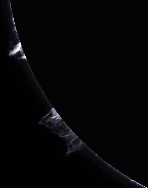
A nice pair of prominences hung above the Sun's limb.
Prominences (Click for full detail.)
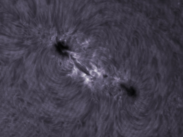
One major sunspot group, designated 1726, was also visible. The following three images show 1726 at three increasing magnifications made possible by two Barlow lenses in use for the first time. The lowest magnification was obtained with a new 1.5X Barlow which barely, barely reached focus with all elements in the optical path pushed in as far as possible. The highest magnification was obtained with a new 5X Barlow which gave a very nice frame-filling view, but requires steadier seeing to show sharper detail.
Sunspot group 1726 imaged with 1.5X Barlow lens (Click for full detail.)
Sunspot group 1726 imaged with 2X Barlow lens (Click for full detail.)
Sunspot group 1726 imaged with 5X Barlow lens (Click for full detail.)
Notice the annoying parallel curved interference fringes in the last image. These are caused by multiple reflections somewhere in the optical path. I still haven't figured out how to get rid of these. The edges of features are a bit fuzzy due to poor seeing.

One other smaller sunspot 1727 was accompanied by a curved filament.
Sunspot 1727 imaged with 1.5X Barlow lens (Click for full detail.)
Sunspot 1727 imaged with 5X Barlow lens (Click for full detail.)
The magnified1727 image above is a bit sharper than the previous magnified 1726 image. An inverted version of the 1727 image highlights the floating nature of the curved filament and the depressed aspect of the sunspot.
Floating filament near sunspot 1727 (Click for full detail.)
I'm looking forward to more observing sessions in the coming months when the weather is warmer, the seeing is better, and the Sun approaches the peak of its activity cycle.

Friday, April 19, 2013

Williamsburg Bike Trails!

Exploring Bike Trails

My daughter's new house in Williamsburg has easy access to beautiful interconnected bike trails. I recently spent four wonderful days exploring them. Here is the Powhatan Creek Trail passing just a few feet from her back yard.
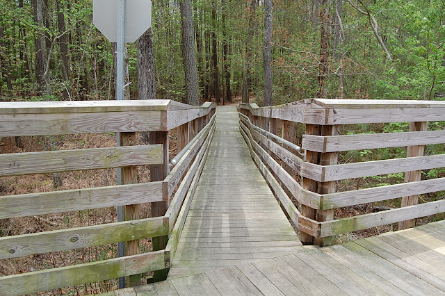
The winding Powhatan Creek Trail has a long wooden section arching over low lying wetlands.
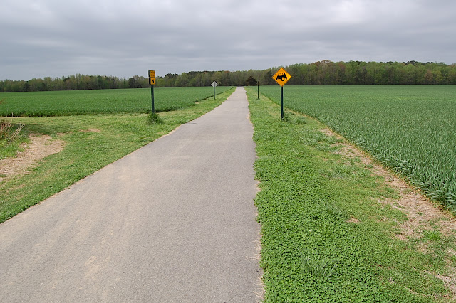
Near its southern end the Powhatan Creek Trail heads through open fields towards its intersection with the Virginia Capital Trail.
Williamsburg and Jamestown are rich in history. The trail in the image above comes to a T-junction with the Virginia Capital Trail. I turned left at the junction and came upon some of the many historical signs along the route towards Jamestown.
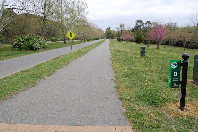
The Jamestown Settlement Historical Museum and the entrance to Jamestown National Park are less than 3 miles from my daughter's house. Across the street from the museum's parking lot I came upon the start of the Virginia Capital Trail whose path is shown on the map below. The bottom map shows how the trail will eventually connect Jamestown to Richmond. I turned around at the zero mile marker shown below and started pedaling toward Richmond.
At first, the Virginia Capital Trail passes beside open farm land and horse pasture. It then winds through some woods toward a quarter mile-long wooden bridge over wetland. The next three pictures show this portion of the journey.
The path continues through pleasant pines toward Route 5 where the trail turns left and heads west.
For the next few miles the trail runs parallel to Route 5.
Only a few miles later, just over 6 miles from the start, the trail comes upon the Chickahominy River and the polysyllabic Wowinchapuncke sign. Here's the scene approaching the Chickahominy River Bridge.
The trail goes over the bridge and offers some turnouts to view the river from the bridge.
Unfortunately, the trail ends just beyond the Chickahominy River. Its construction continues along Route 5 in several places. Some segments have been completed, and travelers on Route 5 can see where other segments are being cleared and prepared for paving. Eventually, the Virginia Capital Trail will stretch more than 40 miles between Jamestown and Richmond.

Closer to Williamsburg the bike trail intersects several portions of the unpaved Greensprings Interpretive Trail, a trail for hiking and nature observation. The whole area is a hiking and biking paradise. Three different entrances to the Greensprings Trail are shown below.
My wonderful new bike leaning against the railing of a quarter mile-long wooden bridge.
On future visits to Williamsburg I hope to continue exploring ways to combine the bike trails with several low traffic subdivisions in order to get longer rides. Williamsburg is flat compared to hilly Lynchburg. I used only 3 different gears during my Williamsburg excursions.

Wednesday, April 10, 2013

Riding the High Bridge Trail - Part 1

Warm Weather!

Beautiful spring has arrived! On April 8th we rode out and back on the western half of the High Bridge Trail between Pamplin and Farmville in Virginia. Plenty of sunshine, temperatures in the mid-seventies, and a nice breeze made the day almost perfect. Below, our bikes are ready to begin the journey at the western end of the trail near Pamplin. The first of several very nice mile markers gave the distance ahead to the outskirts of Farmville.
Soon after starting we encountered the first of several rest rooms conveniently spaced along the trail. These were first class facilities, far superior to smelly port-a-potties. They all deserve a five-star rating for cleanliness and amazing pleasant smell.
The first four miles were arrow-straight and parallel to Route 460. The trail surface was smooth, fine, white gravel. We had a tailwind, and the first miles felt very easy.
The next three pictures show scenes about 6 miles from the start approaching Prospect, VA.
At about the 6.5-mile point we rode into Prospect, an interesting, old-fashioned, little town. Streets were lined with homes and buildings that looked like they were erected in 1900. There is a large parking lot here, but a small fee is required to use it.
C pedals out of Prospect.
We rode on a Monday and had the trail almost entirely to ourselves.The next two pictures show scenes heading out of Prospect.
Eventually, we crossed under Route 460 as Farmville got closer.
Coming into Farmville we crossed this bridge.
The trail intersects Main Street in Farmville. A bike rental shop is located at the intersection, as well as beautiful, modern rest rooms. There are places to eat nearby.
C stands in front of the black metal bench where we ate lunch in Farmville.
We parked our bikes in the shade and ate a leisurely lunch on a nice shaded bench.
Here's the mile marker at the beginning of our return trip to Pamplin. The round trip was 32 miles.
The old Farmville Train Station has been nicely maintained.
It was a sunny day, and we forgot sunscreen. Our faces, arms, and legs got a bit pink, but the sunburn wasn't too bad. Unfortunately, much of the return trip was into a headwind. I was pleasantly tired and ready to quit by the time we returned to our car.

So, we've seen one half of the High Bridge Trail. To complete the trail we'll start in Farmville, ride over the High Bridge, pedal to trail's end near Burkeville, and then return to Farmville. I'd love to do this next trip soon, but it won't happen for at least another week or two.

Tuesday, April 2, 2013

Riding The Virginia Blue Ridge Railway Trail

Spring! At Last!

Finally! Finally, after weeks of abnormally cold weather, a fine spring day arrived. With temperatures in the mid-60's on April 1st we decided to explore the Virginia Blue Ridge Railway Trail located near the border of Nelson and Amherst Counties. The trail starts in Piney River next to an old rail station on Route 151.
At the trail head.
After a short distance on pavement the trail became hard-packed, sandy gravel.
Scenes along the first section of the trail.
Some blustery winds pushed us along to a bridge just before crossing Route 674, also called Roses Mill Road.
Interesting old house at Roses Mill Road.
We continued through beautiful country with the Piney River on our left.
The clear Piney River parallels the trail here.
Eventually, the Piney River flows into the Tye River. We crossed over the Tye River just after the two rivers join.
Crossing the Tye River.
The trail then continues through scenic country with the beautiful Tye River on its right.
Just after the 6-mile point we passed under Route 29.
The trail ends after about 6.7 miles where a barrier blocks the way.
C at trail's end.
It's a shame the trail is so short! Behind the barrier it's possible to ride about another quarter mile on rough ground until another barrier appears. Beyond this final barrier is the raised roadbed of an operating rail line. It seems unlikely the trail will ever be extended on this end.

The trail is short, but sweet. Trees were leafless on our ride, so we had good, clear, open views all along the trail. Sometimes the wind strengthened, dark clouds passed overhead, and a few raindrops fell. Sometimes glorious warm sunshine lit wonderful pastoral scenes.
I look forward to exploring more bike trails in the next few months. The High Bridge Trail near Farmville is our next target. We transport our bikes with a new, honking big bike rack.
   

People say I'm crazy doing what I'm doing
Well they give me all kinds of warnings to save me from ruin
When I say that I'm o.k. well they look at me kind of strange
Surely you're not happy now you no longer play the game

People say I'm lazy dreaming my life away
Well they give me all kinds of advice designed to enlighten me
When I tell them that I'm doing fine watching shadows on the wall
Don't you miss the big time boy you're no longer on the ball

I'm just sitting here watching the wheels go round and round
I really love to watch them roll
No longer riding on the merry-go-round
I just had to let it go

John Lennon