Thursday, January 31, 2013

Biking The C&O Canal Towpath - Part 3

June 29, 2003

My quest to bike the length of the C & O Canal began on August 18, 2002. At that time I thought the full journey would be completed in three segments over the course of a month or two, but inappropriate weather and scheduling complications delayed the second segment until October 6, 2002. No other opportunities were available before winter, so I was frustrated about my unfinished task for 8 months. Finally, all the pieces fell in place for the final third segment attempt on June 29, 2003. This third segment required the most driving since it was furthest from home.

On Saturday afternoon June 28th we drove about 4.5 hours to our motel in Williamsport, MD. After a restless, noisy night with little sleep I arose at 5:00 Sunday morning anxious to begin the trip. Once the car was packed we drove about 40 minutes west along I-70 to Hancock, MD.
At the start in Hancock, MD.
In Hancock I started pedaling at 6:49 AM from the exact place I ended last October’s journey near the 124-mile point along the canal. It was cool, but not cold. Thin patches of fog floated near damp depressions for the first few miles. Much to my relief, the towpath was in good condition. Since we endured historically high amounts of rain that spring, I feared the towpath would be muddy, puddle-filled, or, worst of all, impassable due to flooding from the nearby Potomac River. Some e-mails posted to a canal bikers’ discussion group talked about terrible muddy conditions, detours, and even a place where river flooding had left a thick deposit of slimy silt over the towpath. Happily, these warnings were about 10 to 14 days old. A week had passed with no rain at all, and none of the towpath disaster locations were along my route for the day. Nature was kind. The trail was in good shape for the entire journey. There was very little mud and no puddles. The mud was easily avoided. The old canal ditch was full of water for most of the journey, however.

The first miles felt great! I was very happy to be under way after so much waiting and anticipation! Pedaling was effortless. I was completely alone. No other bikers appeared along the trail for about 2.5 hours during the first 24 miles!
An aqueduct during the early miles.
This northernmost segment of the canal is also the most remote, so all day I saw many fewer bikers than on previous trips.
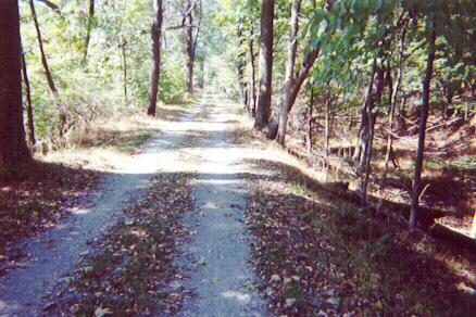
I had the shaded trail all to myself.
I'd rather see wildlife than bikers, so I was happy to see many deer bounding through the woods. One deer jumped out across the trail less than ten yards in front of me! Turtles were out in force. Several were crossing the trail, and more could be seen in the swampy canal, including some huge snapping turtles floating with only their nostrils above water. The wildlife highlight of day was a mother and baby deer walking out in the middle of shallow rapids in the Potomac River! It seemed odd to see deer so exposed in the open during daylight. The mother walked slowly along, but the small baby struggled to keep upright in the rushing water. The baby was the smallest young deer I've ever seen.
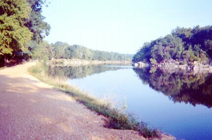
The Potomac River through a rare break in trailside vegetation.
The website I consulted about biking the C & O Canal characterized this particular 60-mile segment as the buggiest of all and suggested bug repellant. Recent heavy rain produced abundant mosquitoes who buzzed and whined around me whenever I stopped. Unidentified bugs flew into my helmet and walked around on my scalp. Twice I had to remove the helmet to get rid of them. During one port-a-potty stop a loud threatening buzz announced the presence of a bumblebee sharing the port-a-potty! Yikes! I made a quick exit and watched the bee buzz my bike for a while. Insects were annoying only when I stopped. While riding there was little problem.

Speaking of port-a-potties … Fortunately, there are plenty of them along the way at campsites, one about every 4 miles or so. Generally, they are in remarkably good condition. As I exited one of the port-a-potties two older woman bikers happened to come along. One of them wanted to use the port-a-potty and asked me, “How was it?” This seemed hilarious to me! First I told her, “It’s pretty good.” Then I said, “It seems pretty strange to be reviewing a port-a-potty! I rate this one an 8.5 out of 10. When you stop holding your breath, you can actually breathe without having your eyes water. Three and a half stars!”

I reached the halfway point in about 3 hours averaging close to 10 MPH. My shoulders were hardly cramped. My legs felt fine. I passed milepost 154. Only about one more mile remained to the famous Paw Paw tunnel named after the nearby town of Paw Paw, WV. For more than 8 months I had been anticipating this moment with some apprehension. The tunnel is about 0.6 miles long. The C & O biking website warned that the tunnel was “VERY DARK” and recommended bringing a flashlight. I feared the tunnel was so long that neither entrance would be visible near the midpoint, and any flashlight malfunction would plunge me into utter darkness. In spite of the guardrail supposedly present to prevent a “steep drop” to the canal, I worried about falling over the edge into the canal in the darkness. So I brought a flashlight with new batteries and carried this extra weight for the whole trip.
Approaching the Paw Paw Tunnel.
The approach to the tunnel was very interesting. A canyon was blasted out of shale to carve out the canal waterway leading up to the tunnel entrance. I biked along the canyon side on a narrow path. The path became a wooden walkway which I followed around a curve until the tunnel entrance itself appeared.
The southern entrance to the Paw Paw Tunnel.
I stopped, took out my flashlight, took a deep breath, and went slowly forward into the tunnel. Immediately my fears disappeared! The tunnel was absolutely straight and light from the distant exit was visible! Although the walkway was less than 3 yards wide, the guardrail was very sturdy and high. There was nothing to worry about. I actually rode slowly for a while along the bumpy path with the flashlight lighting the way. Water dripped from time to time from the beautifully constructed arched brick ceiling. Occasional puddles were easy to step over. It was wonderfully cool inside. Eventually, near the tunnel midpoint, I had to dismount because two people were walking through the tunnel from the other direction. They had no flashlight. I felt a bit silly for worrying so much. Without a flashlight it was possible to walk through by following the silhouette of the sturdy guardrail which is visible even in the dim light from the distant tunnel entrances. Perhaps tunnel passage would have been more difficult on a darker cloudy day when light from the entrances was not so intense.
View from inside the tunnel looking back toward the distant entrance.
From my midpoint dismount I walked the remaining distance through the tunnel. Whistling produced a beautiful echo. In a short time I reached the exit and emerged once again into sunlight.
Looking back toward the tunnel exit after passing through.
The Paw Paw tunnel was built between 1830 and 1850 in order to avoid many miles of winding river and sheer rocky cliffs which the canal would otherwise have had to traverse. It was dug by hand(!) with the aid of explosives by German and Irish laborers. A trailside information sign showed how the tunnel was dug and included pictures of the workers and the construction. I stopped to read almost every sign along the way without concern for lowering my average speed.

After the tunnel I continued on happily. Fatigue slowly built, but only a general tiredness and stiffness between my shoulder blades. I felt less tired on this trip than on the previous two.
A nice view during the final miles.
I passed many locks along the way. Each one had an accompanying house where the lock keeper and his family lived. All of these houses were painted white and had well-maintained exteriors. The windows and doors, however, were all boarded over so no one could enter or even look inside. Finally, about 13 miles from the end of the trip, I came across a lock keeper’s house that was open! An elderly volunteer eager to talk showed me around inside the small house. The walls were made of thick timbers instead of stone or brick like most of the other lock keeper’s houses I had passed. My guide explained how the canal company began running out of money by the time this particular house was built, so they made it out of wood instead of stone or brick. I also learned that barges took from 5 to 7 days to make the entire trip from Cumberland to Washington. The barge crew worked 18-hour days. If a barge took 6 days to make the trip, it would average about 30 miles a day. That doesn’t seem much compared to the 60 miles I was covering in one day, but, of course, I wasn’t hauling tons of coal!
The lock keeper's house I visited. The lock itself is the stone structure to the right.
The final miles passed quickly. Soon I approached the outskirts of Cumberland, MD where the path was very smooth and covered with tiny dark stones. I pedaled into Cumberland, tired, but not exhausted, at 12:47 PM completing a 5-hour 58-minute 60-mile journey. I passed milepost 184 and continued on for approximately another half mile before stopping at an overlook. Before me was the Potomac River. Looking up I saw a waterfall and several criss-crossing bridges over the river as it passed through the heart of Cumberland. Raising my eyes further revealed several interesting old church steeples among the town’s buildings. Cumberland was the starting point of the old canal. A construction project was underway to restore some of the structures that existed when the canal was a major economic force. There will be nice little shops and restaurants to accompany the museum in the bottom of an old train station. Some of the work had been completed, and it looked very nice. Eventually, I found my way through the construction to where C was waiting for me. I had my picture taken next to a statue depicting one of the barge-hauling mules and his driver.
Stubborn mules traveled the full length of the canal.
At trail's end in Cumberland, MD.
In triumph I had biked the entire length of the 184.5-mile long C & O Canal! This coming year I plan to extend my adventure by biking the Great Allegheny Passage trail all the way from Pittsburgh, PA to Cumberland. It's amazing to think you can travel on a dedicated bike trail all the way from Pittsburgh to Washington, DC!

Wednesday, January 23, 2013

Biking The C&O Canal Towpath - Part 2

October 6, 2002

On August 18, 2002 I completed the first 60-mile portion of my quest to bike the entire length of the C&O Canal Towpath. I thought I would attempt the second portion a week or two later. Unfortunately, seven weeks passed before weather and scheduling were favorable. So I began my second ride on a chilly Sunday morning in early October.

At 7:00 AM we loaded our car with biking gear at a Red Roof Inn in Winchester, VA and drove directly to Harper's Ferry, WV, about a 40-minute journey. The local thermometer read 49 degrees! I wore a long-sleeved shirt under my biking shirt, but decided to wear biking shorts and no gloves. I thought it would be better to suffer in shorts a little during a cold start than to suffer more in long pants when temperatures rose later in the day.

I planned to begin biking at 8:00 AM. C was able to drive down into the historic heart of Harper's Ferry and drop me off right next to the bridge over the Potomac River. Since it was early on Sunday morning, no one came to chase us away from the no-parking zone.
Starting in Harper's Ferry at the building where abolitionist John Brown and his followers made a last stand.
A short walk across the bridge brought me to the 60.7 mile point on the trail where I ended the first leg of my canal journey in August. My watch read 7:45 as I set off pedaling. The morning chill quickly became unpleasant. The biking trail was in shadow. Fog banks frequently engulfed the neighboring river and scenery. I pedaled easily at first, partly to loosen my muscles, and partly to diminish the wind chill. Soon, both my hands and feet were numb as I cut through the damp cold. I wished I had brought gloves.

During the first ten miles I noticed several interesting white fungi in the woods. They were enormous, about the size of a bowling ball or bigger, and pure white. At first, I thought they were white plastic shopping bags blown into the woods by wind because their whiteness looked so out of place. Eventually, I realized they were giant fungi. Aside from the fungi, I saw little through the fog. The cold made me stiff and tense. In the gloomy woods along the side of the trail I saw several caves in limestone cliffs beckoning me to explore, but, without a flashlight, cave exploration would have been futile. I passed by the caves.

At 8:45 a motorboat came roaring up the Potomac pulling a crazy water skier. Who would water ski on such a frigid morning? Noise from the boat motor shattered the peaceful stillness and annoyed some campers who were just awakening by the side of the trail. By 9:00 my feet were starting to thaw. I could feel the temperature rise. In the first hour I covered less than 10 miles. After two hours roughly 20 miles had passed. I wanted to maintain a 10 mile-per-hour average speed, so I was right on schedule. Finally, the fog began to clear, my hands were no longer numb, and the trip began to be enjoyable.
The towpath somewhere between milepost 70 and milepost 84.
Eating and drinking were evenly spread out during the journey. I brought three water bottles, two bananas, an apple, and a sandwich bag filled with raisins and cookie crumbs. The apple was an unwise choice because it took too long to stop and eat it. The raisins and cookies worked best. Before leaving home I filled a plastic sandwich bag with raisins. Then I broke two cookies into small pieces and mixed the crumbs with the raisins. A few mouthfuls of this mixture consumed at regular intervals during the trip really hit the spot and kept me energized.

I completed my first 60-mile towpath trip from Georgetown to Harpers Ferry on a hot humid August day. This second expedition had a very different feel to it. It was much cooler, and the air frequently carried the autumn smell of dead leaves. I wondered how beautiful the trail would look when the leaves had truly changed color. Perhaps I’d see beautiful autumn colors if I could manage to ride the final 60-mile section in a few weeks.

Between milepost 84 and milepost 88 flooding had damaged the towpath making it impassable. Towpath travelers had to take a detour on paved country roads. The detour began just after milepost 84 where a pretty dam, called dam number 4, is located on the Potomac.
The Potomac River seen from the top of dam number 4.
I followed detour signs through pleasant countryside and returned to the towpath at McMahon's Mill at milepost 88.1.
View of the Potomac and towpath just past McMahon's Mill.
The town of Williamsport, MD was once an important center of commerce when the canal was operating. Today it features a well-preserved section of canal filled with water.
A well-preserved lock on the approach to Williamsport, MD.
Just after Williamsport at mile point 99.5 I crossed the Conococheague Aqueduct which carried the canal over the Conococheague Creek.
The top of the Conococheague Aqueduct in Williamsport, MD.
Beautiful arches supported the aqueduct. I was able to ride down to the creek bank to photograph the arches.
Arches supporting the Conococheague Aqueduct.
The trail seemed slightly rougher than it was for the first leg of my trip back in August. I blindly rode over branches and bumps hidden by fallen leaves. Now, as I passed Williamsport, my rear end was getting tender from absorbing so many bumps. I also seemed a bit more fatigued than on the August trip, probably due to accumulated stress from my college teaching work.
The towpath somewhere between milepost 100 and milepost 106.
The C&O Canal was strategically important during the Civil War. The canal delivered crucial supplies for the Union. The towpath also provided a good road through wilderness for troop movements. I stopped several times during the journey to read historical markers. About ten miles into my trip the canal crossed Antietam Creek near one of the most famous Civil War battles. The battlefield itself was not visible from the towpath, and I didn’t leave the towpath to find it. At Falling Waters, further along the way, I passed the spot where General Robert E. Lee crossed the Potomac River during his retreat from the battle of Gettysburg.
Dam number 5 on the Potomac River.
At mile point 106.8, after 46.1 miles of pedaling, I came upon dam number five. I could see cliffs on the opposite side of the Potomac from which, according to historical plaques, Stonewall Jackson’s artillery fired across the river in an attempt to destroy the dam. The dam diverted river water for the canal, and Jackson was trying to cut the canal supply to Washington. The lock keeper’s house near the canal must have come under fire from Jackson’s bombardment.
The lock keeper's house near dam number 5.
Nice view from the trail between milepost 107 and milepost 108.
During the final miles I passed a series of well-preserved locks where a small thriving community once flourished when the canal was operating. Some of the old community buildings still stand. Informative plaques at this site explained how mules pulled barges down the canal. Each barge had four mules. Two mules rested in special stalls on the barge itself while the remaining two mules walked along the towpath and pulled the barge. The barge operators treated their mules like family members. Among the remaining buildings in the small community stood a barn where barge operators would house mules for the winter.
Sunny towpath somewhere between milepost 109 and milepost 112.
The dry grass-lined canal on the approach to Hancock, MD.
Fatigue grew as I approached journey’s end in Hancock, MD. The trail was straight for most of the final miles. I watched carefully for bumps and branches to save my tender rear end from unnecessary punishment. At last I arrived at a small bridge leading to the attractive town of Hancock.
Nicely preserved section of the canal in Hancock, MD.
After about 63 miles of pedaling I had arrived at mile point 124.1 at 1:40 PM. The trip took 5 hours and 55 minutes.
Happy biker after completing 63 miles to Hancock, MD.
Only the final third segment of the canal remained. The tale of the third journey will appear in the next post.

Tuesday, January 15, 2013

Biking The C&O Canal Towpath - Part 1

August 18, 2002

The C&O Canal Towpath is a 184.5-mile bike path running between Washington, DC and Cumberland, MD. In 2002-2003 I had great fun pedaling its entire length in three segments. The quest began in August, 2002 just before my classes began. We drove to northern Virginia, stayed overnight in Manassas on a Saturday night, and drove quickly on Route 66 to the beginning of the trail in Georgetown on Sunday morning. An early start was essential because by noon the temperature would be approaching 90 degrees with generous humidity. Immediately after crossing the Key Bridge into Georgetown we made a right turn next to the Francis Scott Key Park. No parking is allowed on this street, but it was early in the morning, and we were able to quickly unload my bike near the Ukrainian embassy. Within minutes someone came out of the embassy and told us to move the car.

My watch said 6:55 AM as I began pedaling at roughly the one-mile marker on the towpath. There was no sense trying to start at mile zero since that spot was inconveniently located. I carried three water bottles, two bananas, an apple, two cookies, some raisins, and a crummy waterproof disposable film camera left over from C’s disappointing Hawaiian snorkeling adventure. All this, along with my wallet, change purse, and eyeglasses fit in my belt bag and the pockets of my biking shirt!

It was a relief to begin the journey. I worried quite a bit before the trip about how long it would take and how rough the trail would be. It turned out to be no problem. The trail was in excellent condition, much better than the Virginia Creeper Trail. The towpath was fairly soft light-colored dirt, not too loose, and not too hard-packed. Some small gravel was mixed with the dirt, but more than 90 percent of the trail was flat, smooth, and a joy to ride. I hoped to be able to manage an average of ten miles per hour for the trip. When a trail is too rough, however, it can be an effort to maintain such a speed. Again, it was no problem, especially during the last half of the trip. When I rode further north on this trail, I didn’t worry so much beforehand.
Typical scene from early miles - smooth path with canal on right.
The first miles were very pleasant. I pedaled along easily looking at the scenery. The canal was on my right. It was filled with murky, unattractive water. In fact, most of the canal water was uninviting. It was either dirty opaque green, completely covered with green algae, or choked with weeds. Only a few places had clean water! The Potomac River was on my left for the whole trip. All along the way people were out walking, running, or biking.
Unattractive green scum mars beauty of the canal.
After about 10 miles the path became prettier. Although I pedaled slowly, paused several times to take pictures, and stopped to adjust my gear, I still managed to cover about 10 miles in the first hour. That put my mind at ease. I allowed seven hours for the 60-mile trip with an additional hour of insurance time, and I was now confident that I would reach Harper’s Ferry well before eight hours had elapsed. Then C would not have to execute any of the emergency plans we made in case I didn’t show up in eight hours. Between 10 miles and 22 miles the ride was beautiful. I felt exhilarated and very comfortable riding smoothly along the shaded trail. I passed several locks, each accompanied by a little white stone house where the lock keepers once lived.
A lock keeper's house.
I imagined how slowly the barges must have traveled along the canal pulled by horses or mules clip-clopping down the very same towpath on which I was riding. I also wondered if a six-hour journey from Harper’s Ferry to Washington would have been considered impossibly fast in 1850!
Another white lock keeper's house and lock.
I passed by Great Falls Park and stopped to look out over the rocky gorges of the Potomac River. Soon I came to the “rocky breach”, a place at mile point 13.4 where the towpath must have been destroyed. Here the canal widened into what looked like a quarry lake filled with the cleanest canal water I would see. It was also one of the most scenic spots along the journey, so I’m glad I decided to skip the detour around it.
Scene approaching the "rocky breach".
The path at the “rocky breach” became very narrow, and then impossible to ride. Tree roots and boulders protruded from the ground along the edge of the water. For a short distance I had to lift my bike upon my shoulder and carry it over the rough terrain. This was hard work. I had to step carefully to keep from twisting my ankle or losing my balance. Fortunately, this section was very short. I carried the bike for, perhaps, ten minutes or so. Then the nice smooth path resumed.
Rough path in the "rocky breach".
After roughly 22 miles the canal bed was no longer filled with water. The depressed bed itself was plainly visible, but it was mostly overgrown with trees. The lack of canal water was no loss to me! Shade from trees growing in the dry canal was more pleasant than dirty canal water! Now the path became a shady country lane passing through woods. I loved it!
The towpath became a shady country lane.
As the 25-mile point and then the 30-mile point passed, I monitored my condition. I wasn’t tired. I was still enjoying the ride tremendously. The shade was lovely. It wasn’t too hot. The breeze from riding along was pleasantly cool. I continued to eat and drink regularly. My shoulders were very slightly cramped, but hardly a problem. So far, so good, I thought.
The ferry named General Jubal Early crosses the Potomac at White's Ferry.
At the 35.5-mile point I stopped at White’s Ferry to eat my second banana. While eating I stood in the shade and watched a small ferry crossing the Potomac. The fare was $3 for cars and $1 for bicycles. The ferry was named after General Jubal Early, a Confederate Civil War leader from Lynchburg who crossed the Potomac near here during the Civil War in an attempt to march down the towpath and attack Washington. There was a snack bar here and port-a-potties, so it was a good spot to take a break. Even with the 15-minute break, I was still averaging slightly more than 10 miles per hour. As I resumed pedaling I wondered when I would begin to feel tired. While passing the 40-mile point I decided that I was still having a lot of fun. Fatigue hadn’t hit yet. Soon I reached another landmark at mile 42.1 where I crossed the Monocacy Aqueduct. Here the canal, contained within a stone bridge completed in 1833, actually crossed over a river! Metal supports were added in the 1970’s, and these made it impossible to ride across the bridge. It was actually a nice break to get off the bike and walk across while guiding the bike over each bump along the way.
Walking my bike over bumps on the Monocacy Aqueduct.
After the aqueduct the path plunged into shady woods again. The Potomac River was frequently visible to my left through breaks in the trees. People were fishing and kayaking on the river. About every five miles along this section there were campsites with grills, port-a-potties, and hand pumps for water.
Lovely shady woods.
As 50 miles approached it was impossible to deny growing fatigue. My shoulders were getting tired. Perhaps I was 75 percent comfortable and 25 percent uncomfortable at this point. It was good to know I would arrive in Harper’s Ferry with time to spare. 50 miles were completed in less than five hours. I continued to chug away and cover the miles. At the 54-mile point I passed the Brunswick Family Campground where the smell of grilled hot dogs and hamburgers drifted into my nose. I thought folks there might be amused if I told them I had ridden all the way from Washington and would pay $10 for a hot dog!

Harper’s Ferry was not far off now. I expected to see it around every bend. The miles continued to pass. Soon I could see people floating down the Potomac in inner tubes. That meant the journey’s end was coming very soon. I passed the 60-mile mark and knew there was less than a mile to go! I arrived at the base of the bridge to Harper’s Ferry at exactly 12:30 PM. It had taken 5 hours and 35 minutes to bike approximately 60 miles to this spot!
Endpoint of my ride beneath railroad bridges at Harper's Ferry.
I felt a little tired but great overall! I wasn’t exhausted or breathing rapidly. There was time to read some of the informative plaques near the path before carrying my bike up the stairs to the bridge into Harper’s Ferry. A train then crossed a neighboring bridge and passed into the impressive tunnel there. That added a nice touch to the journey’s end. I stepped off the bridge, removed my helmet, and strolled slowly down to the armory where John Brown was captured. I ate a few raisins and drank a little water. Within a minute or two C appeared. She had just arrived.

Our car was parked at the Harper’s Ferry Visitor’s Center about two miles away. C had taken a shuttle bus from the Visitor’s Center down to the town to meet me. No bikes are allowed on the shuttle bus. I foolishly suggested we walk back to the Visitor’s Center together. That was a mistake! The walking trip was much longer than expected. Although I biked 60 miles without too much trouble, this final walk nearly did me in! During the final mile I struggled to push my bike uphill in unshaded 90-degree humidity. By the time we got to the car I was completely exhausted and sweating heavily. It was a real effort to take the bike apart and load all of my equipment in the steaming car. Finally, I changed clothes in the restroom at the Visitor’s Center, and we drove off with air conditioning on maximum.

I'll share the second part of the story in my next post.

Monday, January 7, 2013

Poplar Forest 3D

Jeffersonian Architecture

Instructions for how to view stereo images with the cross-eye method can be found here, here, and hereClick on the images below for better viewing. When you click on these images they are displayed in new larger windows with fewer surrounding distractions.

I live about one mile from Thomas Jefferson's second home in Poplar Forest. Jefferson designed this octagonal house located on a hill in the midst of his plantation. The house was his private retreat from Monticello. The first stereo pair below shows the side and rear of the house. 


This next image shows the rear porch in particularly strong 3D even though the background trees on the left and right don't show properly. Concentrate on just the porch area. Don't be distracted by the fuzzy background.


I moved behind the house to capture this stereo pair.


Moving off further to my right gave another view of the back porch and a reflection of the late afternoon Sun.


Here's a view showing the wing of service rooms where the kitchen, laundry, smokehouse, and storage room were located.


Finally, here is a classic "tunnel view" along the walkway leading to the entrances of rooms located in the service wing.


People say I'm crazy doing what I'm doing
Well they give me all kinds of warnings to save me from ruin
When I say that I'm o.k. well they look at me kind of strange
Surely you're not happy now you no longer play the game

People say I'm lazy dreaming my life away
Well they give me all kinds of advice designed to enlighten me
When I tell them that I'm doing fine watching shadows on the wall
Don't you miss the big time boy you're no longer on the ball

I'm just sitting here watching the wheels go round and round
I really love to watch them roll
No longer riding on the merry-go-round
I just had to let it go

John Lennon