On August 18, 2002 I completed the first 60-mile portion of my quest to bike the entire length of the C&O Canal Towpath. I thought I would attempt the second portion a week or two later. Unfortunately, seven weeks passed before weather and scheduling were favorable. So I began my second ride on a chilly Sunday morning in early October.
At 7:00 AM we loaded our car with biking gear at a Red Roof Inn in Winchester, VA and drove directly to Harper's Ferry, WV, about a 40-minute journey. The local thermometer read 49 degrees! I wore a long-sleeved shirt under my biking shirt, but decided to wear biking shorts and no gloves. I thought it would be better to suffer in shorts a little during a cold start than to suffer more in long pants when temperatures rose later in the day.
I planned to begin biking at 8:00 AM. C was able to drive down into the historic heart of Harper's Ferry and drop me off right next to the bridge over the Potomac River. Since it was early on Sunday morning, no one came to chase us away from the no-parking zone.
 |
| Starting in Harper's Ferry at the building where abolitionist John Brown and his followers made a last stand. |
During the first ten miles I noticed several interesting white fungi in the woods. They were enormous, about the size of a bowling ball or bigger, and pure white. At first, I thought they were white plastic shopping bags blown into the woods by wind because their whiteness looked so out of place. Eventually, I realized they were giant fungi. Aside from the fungi, I saw little through the fog. The cold made me stiff and tense. In the gloomy woods along the side of the trail I saw several caves in limestone cliffs beckoning me to explore, but, without a flashlight, cave exploration would have been futile. I passed by the caves.
At 8:45 a motorboat came roaring up the Potomac pulling a crazy water skier. Who would water ski on such a frigid morning? Noise from the boat motor shattered the peaceful stillness and annoyed some campers who were just awakening by the side of the trail. By 9:00 my feet were starting to thaw. I could feel the temperature rise. In the first hour I covered less than 10 miles. After two hours roughly 20 miles had passed. I wanted to maintain a 10 mile-per-hour average speed, so I was right on schedule. Finally, the fog began to clear, my hands were no longer numb, and the trip began to be enjoyable.
 |
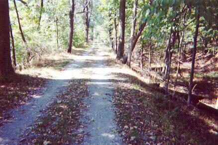
| The towpath somewhere between milepost 70 and milepost 84. |
I completed my first 60-mile towpath trip from Georgetown to Harpers Ferry on a hot humid August day. This second expedition had a very different feel to it. It was much cooler, and the air frequently carried the autumn smell of dead leaves. I wondered how beautiful the trail would look when the leaves had truly changed color. Perhaps I’d see beautiful autumn colors if I could manage to ride the final 60-mile section in a few weeks.
Between milepost 84 and milepost 88 flooding had damaged the towpath making it impassable. Towpath travelers had to take a detour on paved country roads. The detour began just after milepost 84 where a pretty dam, called dam number 4, is located on the Potomac.
 |
| The Potomac River seen from the top of dam number 4. |
 |
| View of the Potomac and towpath just past McMahon's Mill. |
 |
| A well-preserved lock on the approach to Williamsport, MD. |
 |
| The top of the Conococheague Aqueduct in Williamsport, MD. |
 |
| Arches supporting the Conococheague Aqueduct. |
 |
| The towpath somewhere between milepost 100 and milepost 106. |
 |
| Dam number 5 on the Potomac River. |
 |
| The lock keeper's house near dam number 5. |
 |
| Nice view from the trail between milepost 107 and milepost 108. |
 |
| Sunny towpath somewhere between milepost 109 and milepost 112. |
 |
| The dry grass-lined canal on the approach to Hancock, MD. |
 |
| Nicely preserved section of the canal in Hancock, MD. |
 |
| Happy biker after completing 63 miles to Hancock, MD. |
No comments:
Post a Comment